Australia’s Bureau of Meteorology has declared a La Niña event is under way in the Pacific, joining other international agencies to mark a weather pattern that typically elevates flood risks for much of the country.
In its fortnightly update of Australia’s climate drivers, the bureau said key atmospheric and oceanic indicators of the El Niño–Southern Oscillation (Enso) showed “an established La Niña”.
“Tropical Pacific sea surface temperatures have been cooling since June and are now at La Niña thresholds,” the bureau said.
@BOM_au confirms a La Nina is underway in the tropical Pacific. pic.twitter.com/KcKQruO3oT
— Peter Hannam (@p_hannam) September 13, 2022
“Models indicate this La Niña event may peak during the spring and return to neutral conditions early in 2023,” it said, noting that such events increase the chances of above-average rainfall for northern and eastern Australia during spring and summer.
The bureau’s fortnightly update of Australia’s climate drivers had been at “alert” level for some weeks, implying a 70% chance the thresholds it uses to declare such an event will be crossed later this year.
Meteorological models have been indicating since March that a third La Niña event in as many years has been a reasonable prospect. Such so-called “three peat” La Niña’s are relatively rare, with some agencies listing 1954-57, 1973–1976 and 1998–2001 as previous ones.
During La Niñas, the typical east-to-west equatorial winds strengthen in the Pacific, enhancing the likelihood of above-average rainfall in the spring and summer in much of Australia and south-east Asia. Conversely, other regions are relatively dry, such as western parts of the Americas.
Ben Domensino, a senior meteorologist with Weatherzone, said conditions in the Pacific had been lingering near the bureau’s standard for a La Niña for some weeks and it would not be surprising if Tuesday’s update saw a formal declaration.
“It’s close to, if not exceeding, that threshold,” Domensino said, noting other agencies, including the World Meteorological Organization – which use slightly lower measures – have already predicted a La Niña will occur later this year.
The Pacific, though, is only one of the influences on Australia’s climate. The Indian Ocean dipole – which tracks relative sea-surface temperatures in the western and eastern regions of the basin – is now in its negative phase. That phase tends to increase the likelihood that cloud bands bringing above-average rain to south-eastern Australia will bring damp weather to the western side of the Great Dividing Range.
The Southern Ocean, too, is primed to contribute additional rainfall for southern parts of Australia. Together, the three regions point to another relatively wet spring and early summer at least for much of the country.
“It won’t be good news for flood risks,” Domensino said.
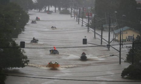
South Lismore resident Harper Dalton is still working on repairing major damage inflicted on his home by flood waters in February and said the possibility of another La Niña was “very stressful”.
“[The declaration] is going to cause a big storm for the town,” he said.
He hasn’t been able to get reinsured since this year’s flood and is now trying to plan for the next season.
“I will probably just stay here until we get a big flood warning and then sleep in my car,” he said.
after newsletter promotion
Agus Santoso, a senior research associate at the University of New South Wales’s Climate Change Research Centre, said a bureau declaration of a La Niña on Tuesday would not be a big surprise.
“A La Niña has been lingering for many months,” Santoso said. “It hasn’t died … It’s fair to say there’s a La Niña happening.”
He said it didn’t look like the third part of the La Niña series would be an extreme one, a point supported by the latest model runs.
For now, @BOM_au is not predicting the La Nina will get much more intense before it starts to declare in early summer. pic.twitter.com/InKIzj5prs
— Peter Hannam (@p_hannam) September 13, 2022
Still, above-average rainfall won’t be welcomed by regions already hit by floods in the past two years, and such an event will also bring the risk of a busier than usual tropical cyclone season.
The past two cyclone seasons – which run from the start of October to the end of April, were both predicted to have slightly above-average cyclonic activity.
The negative Indian Ocean Dipole has a ways to run, indicating odds for more of those north-west cloud bands bringing extra moisture into the country's southeast. (Source: @BOM_au ) pic.twitter.com/cBSsflMzCy
— Peter Hannam (@p_hannam) September 13, 2022
As for a fourth La Niña year is a row? “It’s not impossible to have one but I’d expect a neutral year or an El Niño one,” Santoso said.
The current long-range weather forecast, issued by the bureau last week, predicts above average rainfall for the eastern half of the country for the rest of the year.
Southern Annular Mode is forecast to remain in its positive phase for rest of spring, @BOM_au says. That means westerly storm tracks have shifted southwards towards Antarctica, meaning places such as western Tasmania (with its important dams) will be drier than usual.(ht@tasvo) pic.twitter.com/1t47QCFM7m
— Peter Hannam (@p_hannam) September 13, 2022
The bureau said the Southern Ocean’s influence will also tend to favour above-average rainfall. The so-called southern annular mode – which gauges how far north or south the storm tracks circling Antarctica – is predicted to be in its positive phase for the rest of spring.
“During the spring months, a positive SAM has a wetting influence for parts of eastern NSW and far eastern Victoria, but a drying influence for western Tasmania,” BoM said.
Western Tasmania, along with the south-west corner of Western Australia and the Top End of Northern Territory, have been among the few regions of the country to report below-average rainfall so far in 2022.
