SAN FRANCISCO—Three years ago, scientists discovered that ice loss in Greenland and Antarctica has accelerated since 1992 due to climate change.
Now the same group of scientists has launched an initiative to use satellite data to continually monitor changes in ice mass at the poles. Their work will be made easier in the coming years as space agencies around the world are launching new satellites to track polar ice.
“There are processes we know about that happen in the ice sheet—we can see them on land, and from sky and space—that can cause them to destabilize really quickly,” said Andrew Shepherd, a professor of earth observation at the University of Leeds.
On supporting science journalism
If you're enjoying this article, consider supporting our award-winning journalism by subscribing. By purchasing a subscription you are helping to ensure the future of impactful stories about the discoveries and ideas shaping our world today.
The initiative, called IMBIE (ice mass balance inter-comparison exercise), is meant to address one of the fundamental unknowns about climate change: By how much will sea levels rise in the next century, and what is the probability of disastrous sea-level rise? The Intergovernmental Panel on Climate Change estimates that sea levels will likely rise by 26 to 82 centimeters by 2100. But some scientists have suggested that the rise could be a meter (3.2 feet) by the end of the century.
These numbers are extremely uncertain because global climate models, which re-create the atmosphere-ocean-land system, do not include detailed ice sheet processes. That means that contributions to sea-level rise driven by instability in the ice sheets do not get factored into estimates.
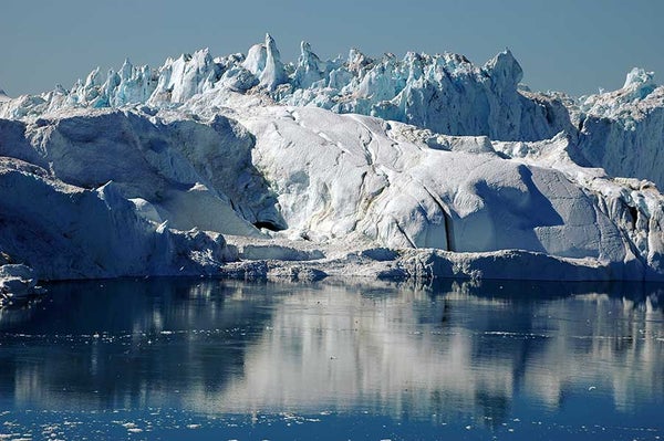
Scientists have noticed a number of processes destabilizing ice sheets. For instance, ice melt at the surface flows to the bed of a glacier, causing it to slide more quickly into the ocean. The disintegration of ice shelves, which are fingerlike projections of ice that float on the ocean and plug the flow of glaciers, also increases the rate of glacial flow into the sea.
Satellite data suggest that destabilizing processes have significantly increased the rate of sea-level rise since the 2000s, Shepherd said at an American Geophysical Union meeting last month.
Data and beyond
Scientists have used satellite measurements of the poles to calculate the loss from the Antarctic and Greenland ice sheets. But their techniques have varied widely. So in 2012, a global community of scientists, led by Shepherd, synthesized the various studies and provided a cohesive picture of changes at the poles.
Their study, published in Science in November 2012, found that the Greenland and West Antarctica ice sheets raised global sea levels by 11.1 millimeters between 1992 and 2011. This accounted for one-fifth of the observed sea-level rise (ClimateWire, Nov. 30, 2012).
“We take all the data collected and make good use of it, and we replace 40 or 50 assessments of ice sheet losses with a single record that people can trust because it’s a community assessment,” Shepherd said.
Since 2012, about 100 new studies have been published about Greenland and Antarctic ice sheets. That prompted the polar scientists to launch IMBIE last month in order to update their study every year. Their record would stretch over 40 years, as opposed to 19 in the previous study.
“Now, we have 15 satellite missions; we can go backward in time, making use of earlier satellite missions; and we know there are new missions on the horizon to give us better data,” Shepherd said.
The European Space Agency this year will launch Sentinel-3, which will measure topography over ice sheets and sea ice; NASA and the German Research Center for Geosciences will launch the GRACE follow-on in 2017, which will measure the weight of the polar ice sheets and track changes in mass; NASA will launch ICESat-2 in 2017 to measure the change in shape of an ice sheet; and NASA and the Indian Space Research Organization will launch the NISAR mission in 2020 to measure the speed of ice flow.
NASA’s focus is to go beyond just collecting data to bringing together scientists across fields of research to better understand the processes behind ice sheet destabilization, said Thomas Wagner, a program scientist at NASA.
Listening to the ice
“One of the things we need to do is change the way we view the ice in Antarctica,” Wagner said. “It is not that we are assembling information to predict how the ice will change; rather, the changes we are observing in the ice tell us about a lot of other things.”
NASA is also promoting CubeSats, which are miniature cuboid satellites—about the size of a loaf of bread—built using off-the-shelf components and launched, often for free, into low Earth orbit. For instance, the RainCube CubeSat, to be built next year, would measure rainfall from space.
“These satellites are in development right now,” Wagner said.
The ultimate goal of the scientists is to improve climate models and the certainty of sea-level rise projections. The 2012 IMBIE study has been widely used by the modeling community.
A modeling study published last month in Nature found there is a 5 percent chance that Antarctica ice melt would raise sea levels by 30 centimeters in the next century. And there is a 50 percent chance that sea levels would increase by 10 centimeters.
The study found that sea levels are unlikely to rise by more than half a meter.
“It is really important to put bounds upon the potential sea-level rise we might see from the ice sheets, and that’s our job these days,” Shepherd said. “How likely is a 1 meter of sea-level rise? Those are the sorts of questions we want to answer.”
Reprinted from Climatewire with permission from Environment & Energy Publishing, LLC. www.eenews.net, 202-628-6500