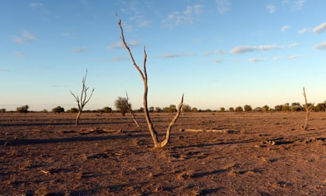
Australia will be hit by a “substantial” El Niño event for the first time in five years, heightening the chances of widespread drought and warmer temperatures, the Bureau of Meteorology has confirmed.
The BoM said the El Niño phase will become the “dominant influence on Australian climate during the second half of the year”. The tropical Pacific is already in the early stages of the event.
El Niño is a periodic climatic event that occurs when tropical Pacific waters warm, affecting wind circulation patterns. The winds push warm waters westwards, towards Australia.
Although no El Niño periods are the same, in Australia they are generally associated with less rainfall, warmer temperatures, shallower snow depths and higher fire risk. Of the 26 El Niño events since 1900, 17 have resulted in widespread drought.
The warmer ocean waters also pose a risk to the corals of the Great Barrier Reef, which can bleach and die in extreme temperatures.
“This will be quite a substantial El Niño event,” said David Jones, a climatologist at BoM. “This isn’t a weak one or a near miss as we saw last year.”
In 2014, the BoM anticipated an El Niño period due to warming oceans, but the atmospheric conditions did not tally. The confirmation of a full El Niño event is the first in Australia since March 2010.
“The most obvious thing we know is that El Niño events tend to lead to drier winter and spring periods,” Jones said. “There is an increased risk of drought which obviously isn’t good for people already in drought.
“Australian temperatures are already warming and El Niño tends to give those temperatures a boost, so we’d expect winter, spring and even early summer to have well above average daytime temperatures.”
El Niños have raised daytime temperatures on average by 1.5C in Australia in the past. However, they also bring cooler nights which means there are more frosts.
The pattern also makes floods less likely and it is expected to reduce the number of cyclones expected in northern Australia.
“We’d expect this El Niño to peak in intensity around spring and early summer, lasting to February perhaps,” Jones said. “We’d hope for a one-in-10 scenario where we’d fluke a bit of rain but it’s likely that dry conditions will emerge.”
Jones said that despite the El Niño event, it was “very unlikely” that 2015 would be Australia’s hottest year, due to cooler months in the first half of the year.
However, he said there was a “significant probability” that the world would have its warmest year, beating the mark set in 2014.

Comments (…)
Sign in or create your Guardian account to join the discussion